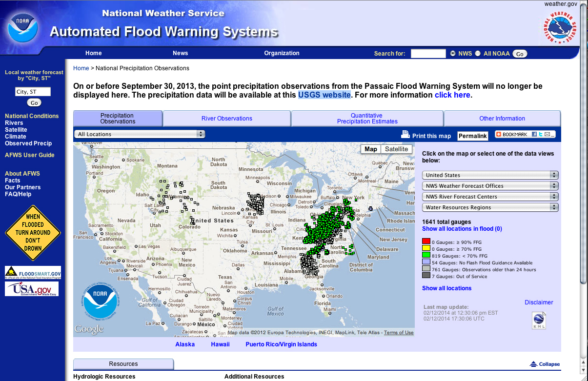
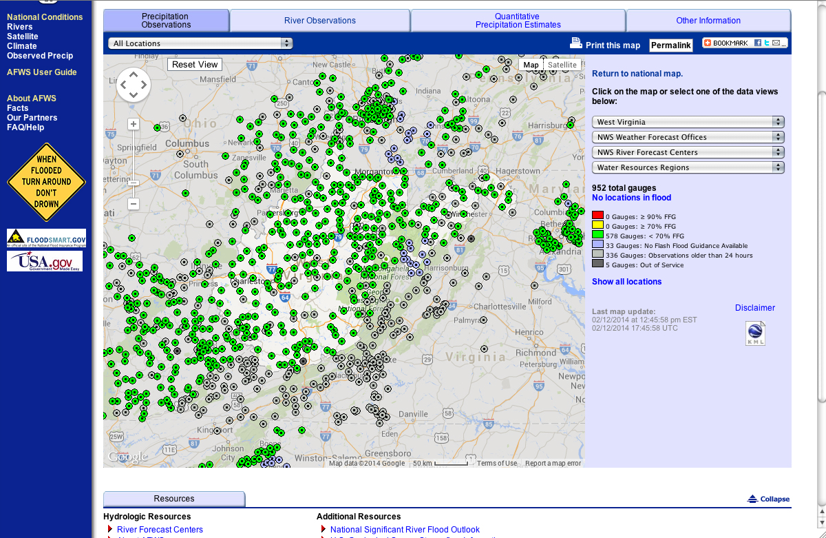
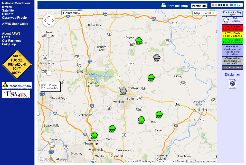
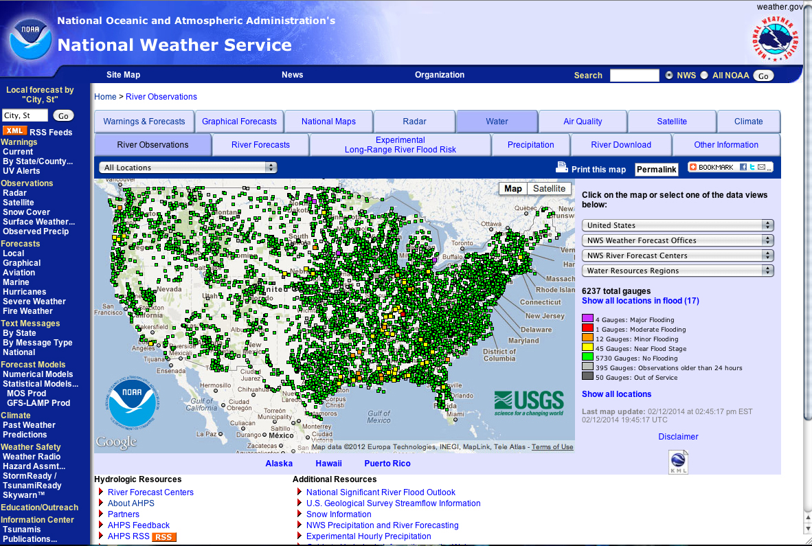
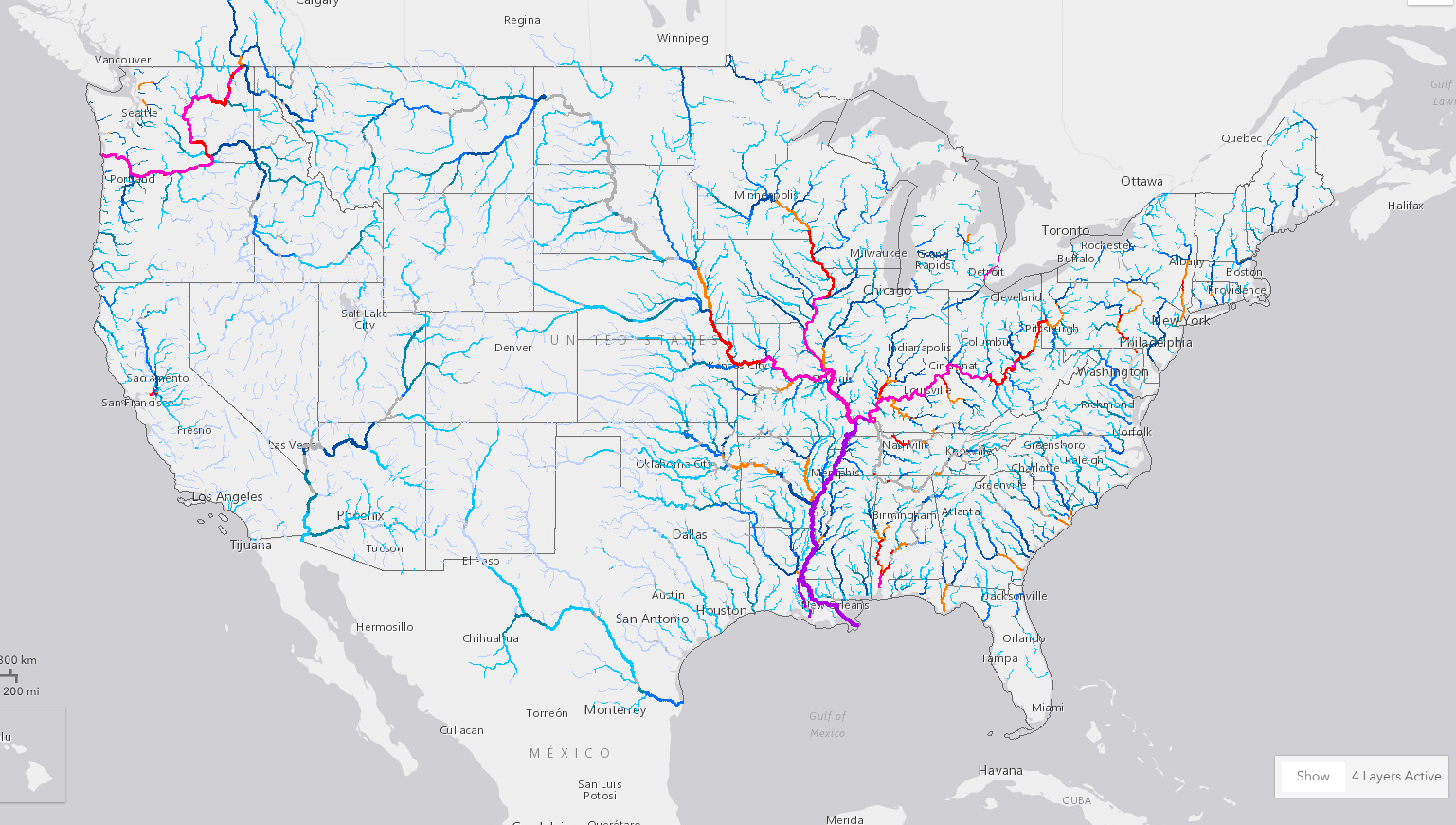
About

Who We Are. Where We're Headed.

Home » About
Our Mission

Organize the World's Information and Make It Universally Accessible

Our History

1998
2003
2004
2005
2008
2011
2014
2017
2020
1998

Automated Flood Warning Systems

The Automated Flood Warning Systems (AFWS) is a network of numerous local flood-warning systems, rain gauges that integrate and share information from 1900 sensors in 12 states.

The goals of the IFLOWS Program are:

  • Substantially reduce the annual loss of life from flash floods
  • Reduce property damage
  • Reduce disruption of commerce and human activities
2003

Advanced Hydrologic Prediction Service

The Advanced Hydrologic Prediction Service (AHPS) is a new and essential component of our Climate, Water, and Weather Services. AHPS is a web-based suite of accurate and information-rich forecast products. They display the magnitude and uncertainty of occurrence of floods or droughts, from hours to days and months, in advance.

water-weather-gov-ahps

2004

2004 – Our year for Climate

In the early part of 2004, ONS began the construction of the Weather.gov/Climate website where the website displays detailed daily weather statistics including temperature, precipitation, degree days and wind. Since the initial construction, ONS has added in more functionality such as humidity, sunrise/sunset, and record temperature data via text-based products.

Local 3-month Temperature Outlook

Towards the end of 2004, ONS created The Local 3-month Temperature Outlook (L3MTO) product. The product provides probabilistic local forecasts of 3-month average daily mean temperatures for thirteen consecutive 3-month periods (January-February-March (JFM), February-March-April (FMA), etc.).

2005

West Virginia Division of Homeland Security and Emergency Management Flood Warning System

In April of 2005, ONS was contacted to update and maintain the www.rainfall.net website.

The purpose of the Integrated Flood Observation and Warning System (IFLOWS) is to reduce the annual loss of life from flash floods, reduce property damage, and reduce the disruption of commerce and human activities.

Precipitation Mapping

In the later part of 2005, ONS was contacted to update and maintain the https://water.weather.gov/precip website.

Precipitation mapping is a system that takes raw data provided by NWS, converts said data to a graphical representation, and serves this data to a frontend interface where it can be examined by the user. This system has recently been upgraded to a full tile system used to serve large quantities of graphics to users quickly with low client-side costs.

2008

Flood Inundation Mapping

The National Weather Service Inundation Mapping Interface is a web-based tool that is integrated into the AHPS web suite and provides flood inundation maps that show the extent of flooding expected spatially over a given area. This is a geographic information system (GIS) project that ONS developed for the National Weather Service Office of Hydrologic Development in conjunction with the Office of Climate Water and Weather Services, US Army Corps of Engineers, and US Geological Survey. ONS has developed 94 sites to date with additional sites planned to be completed in the next few years since becoming a national-level project.

water-weather-gov-ahps2

2011
nws-weather-gov-lcat

Local Climate Analysis Tool

What is the Local Climate Analysis Tool?

The Local Climate Analysis Tool (LCAT) provides access to climate data and methods for local climate studies to increase user expertise in climate trends in the context of global climate change, answer user inquiries, and link climate to weather and water information.

2014

Scientific/Engineering Achievement Silver Medal

Climate group won the 2014 Group Silver Medal for Scientific/Engineering Achievement for our implementation of the Local Climate Analysis Tool.

nws-weather-gov-lcat
2017

Scientific/Engineering Achievement Gold Medal

The Office of Water Prediction team won a Department of Commerce gold medal for Scientific/Engineering Achievement award partly for Orion’s work to display the National Water Model (NWM).

nws-weather-gov-lcat
2020


What are we currently working on?

It’s a new year. Anything is possible.

Who We’ve Worked With

Interested in knowing more about Orion Network Solutions?